


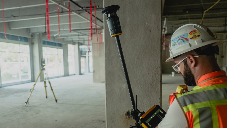
Trimble has released its new-generation surveying system: the Trimble ST30 smart target. This new system integrates optical and subscription-based GNSS functionality into a single solution. Focusing on traceability, redundancy, versatility, and safety, the ST30 introduces tilt compensation and automatic rod height measurements, giving surveyors a dual-use tool for both optical and GNSS applications.
The ST30 is designed for a wide variety of surveying and construction tasks, including topographic surveys, stakeout, as-built verification, and cadastral work. The system integrates with Trimble’s field, office, and cloud software solutions to provide trustworthy, traceable accuracy and enhance the integrity of collected data. These integrations include the Trimble S-, RTS-, or SPS-series of robotic total stations, Trimble Access, Trimble Siteworks, Trimble FieldLink field software, Trimble Business Center office software, and Trimble Connect common data environment.
“The Trimble ST30 smart target enhances what’s possible from a surveying system. It delivers a transformative field experience by ensuring uninterrupted productivity and accuracy with robust, reliable total station tracking,” said Boris Skopljak, senior vice president, geospatial at Trimble. “With optical and GNSS tilt compensation, automated rod height, and integrated GNSS, users can reduce costly errors and work safely in more hard-to-access areas.”
Read the full article here